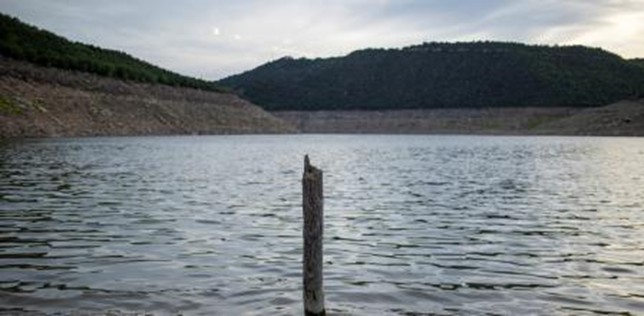
This is the surprising ‘underground sea’ discovered in Lleida: a huge 80 km² reservoir
-
Preliminary work for the next Hydrological Plan reveals a massive groundwater body of 81.62 km² between several towns in the Segrià region.
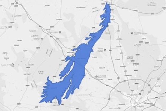
The initial work on the new Ebro Hydrological Plan has yielded two significant discoveries in Lleida, in what is now the Segrià region: the existence of an enormous groundwater body of more than 80 km², whose extremes are located in Alfarràs, Alcarràs, Raimat and El Pla de la Font, and the certainty that there was a vast river network there in prehistoric times.
The Ebro Hydrographic Confederation (CHE) has discovered the existence of a huge reservoir covering an area of 81.62 square kilometers, with its northern and southern ends in Alfarràs and Alcarràs and its eastern and western ends in Raimat and El Pla de la Font. It has been named the Raimat-Monreal Plains.
The aquifer, shaped like a very elongated isosceles triangle, extends 30 kilometers along its north-south axis and occupies just under 10 kilometers along its widest east-west axis.
Until now, the existence of an aquifer of this size in the western part of the Segrià River was unknown. In fact, along with Selgua, Montesusín-Lanaja, and El Torollón-Sariñena, this is one of the four newly located groundwater bodies whose characteristics will be studied during the next hydrological planning cycle, which will officially run from 2028 to 2033.
“There is not enough information to develop an action plan” for the aquifer, states the initial documentation of the new Ebro Hydrological Plan (PHE), neither regarding its hydrological characteristics, nor regarding the impacts it receives or the risks to which it is exposed. “It is a newly created groundwater mass,” and “this data will be obtained from future specific studies,” the document adds.
However, the initial work by the Ebro Hydrological Commission (CHE) technicians outlines some basic information such as its distribution, with more than a third of the aquifer in each of the municipalities of Gimenells i El Pla de la Font (38.4%) and Almacelles (35.8%), significant contributions in Alfarràs and Almenar, lesser contributions in Alguaire, Lleida, and Alcarràs, and indicative contributions in Saidí and Albelda.
In geological terms, the groundwater body “is located within the Ebro Basin and Catalánides hydrogeological domains and corresponds to the Planas de Raimat-Monreal Hydrogeological Unit,” indicates the previous PHE documentation, which adds that “it is located between the Aragón and Catalunya Canal to the east and the Clamor Amarga River to the west. Its recharge, that is, the reception of flows, “occurs mainly through infiltration of precipitation and irrigation returns, while discharges occur through peripheral springs (in the glacis) and the river network (mainly in the alluvial ones), with the rivers within this water body having a predominantly effluent or receiving character.”
Lacking artificial recharge facilities, its hydrogeological dynamics “are controlled by both the region’s topography and the hydrogeological properties of the sedimentary materials,” meaning that “the river terraces and alluvial fans act as natural recharge zones, favoring the infiltration and storage of water” underground, while “the most significant discharges occur into the Clamor Amarga River,” a tributary of the Cinca River in Fraga, which acts as a collector for irrigation returns from the Aragón and Catalunya Canal.
An autonomous body that withstands discharges
This body of water “has no lateral contact with other bodies,” conclude the preliminary work of the CHE (Eastern Water Commission), which designates it as independent. These documents note, albeit “provisionally,” that it is subject to “specific” but at the same time “significant” pressures from both urban and industrial plant discharges, which moderately affect 91.9% of its volume and with low intensity affect 8%.
A cavity beneath what was once a large river more than 25 million years ago
The aquifer area “has experienced a tectonic compression dynamic since the end of the Oligocene,” 34 to 23 million years ago, which “has generated a series of folded structures and reverse faults affecting the sediments,” a process that occurred “with less intensity in the areas closest to Raimat and Monreal,” its largest area. This area, steppe in modern times until the arrival of irrigation, was not always so: it has elements “typical of a floodplain environment” and “deposits from a braided fluvial system of Pyrenean origin” prior to the current “embedded river network.”